Geo Mapping and Aerial Photography
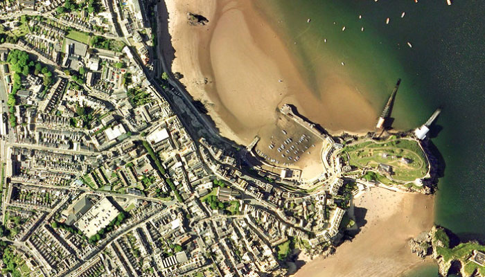
True Ortho photos can be easily obtained by our Fixed Wing UAV
|
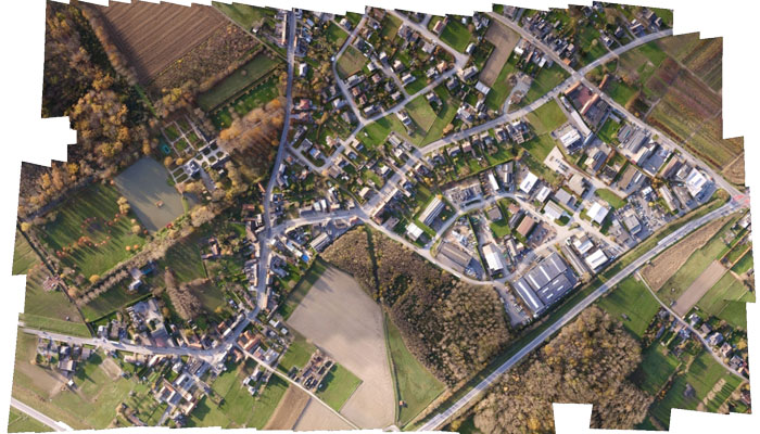
By stitching thousands of images together we can produce aerial photos of any size
|
Utilising UAV technology to achieve aerial surveys has many benefits over conventional methods. Being able to quickly, safely and cheaply gather rich data sets generating dense point clouds with millions of individually calculated points, we can provide true ortho photos and 3D imagery for many industrial applications including -
- Topographical surveys;
- Natural resource management;
- Environmental monitoring;
- Construction progress;
- Quantity surveying; and
- Quarry and mining operation surveys.
With a combination of our fixed wing and rotary UAVs, we have the ability to map large areas with a GSD (Ground Sample Distance - or the size of each pixel in the image) down to 1cm. These fully orthorectified images can then be processed to produce full 3D landscapes of the survey area.
With our Virtual Surveyor software, we can then produce full 3D walkthroughs of each site, allowing calculations such as terrain volumes, realtime calculation of elevation contour lines, slopes, and slope directions, as well as directly importing into CAD or GIS.
With our Virtual Surveyor software, we can then produce full 3D walkthroughs of each site, allowing calculations such as terrain volumes, realtime calculation of elevation contour lines, slopes, and slope directions, as well as directly importing into CAD or GIS.